
Draw an area.
Fly the search.
A free browser tool that turns a polygon on a map into a DJI Pilot 2 waypoint mission — in under 5 minutes. Purpose-built for search-and-rescue, security, and survey teams flying the DJI M30T, M3T, or M4T.
Why we built this
If you've ever needed to systematically cover a search area with a DJI drone, you've probably done one of three things:
- Hand-plotted waypoints in DJI Pilot 2 — slow, error-prone past 10 points, and the strip spacing comes out wrong if you don't do the FOV maths.
- Paid for a desktop mission planner — heavy install, steep learning curve, often locked to a single workstation, often subscription.
- Flown manual sweeps — coverage gaps you only discover when you re-fly the next day.
SAR teams in particular need a fast, predictable, repeatable way to plan systematic coverage when minutes matter. We wanted a tool that does one thing well: draw the area, get the mission file. No installs, no logins, no per-month fees, no learning curve.
What it does
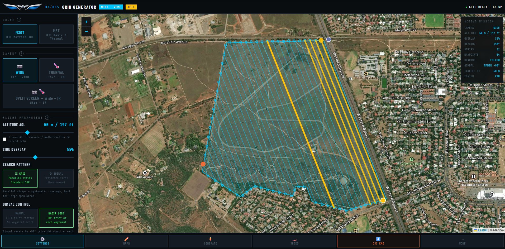
Tap-to-place vertices on a satellite map. Adjust later by dragging — the grid regenerates instantly.
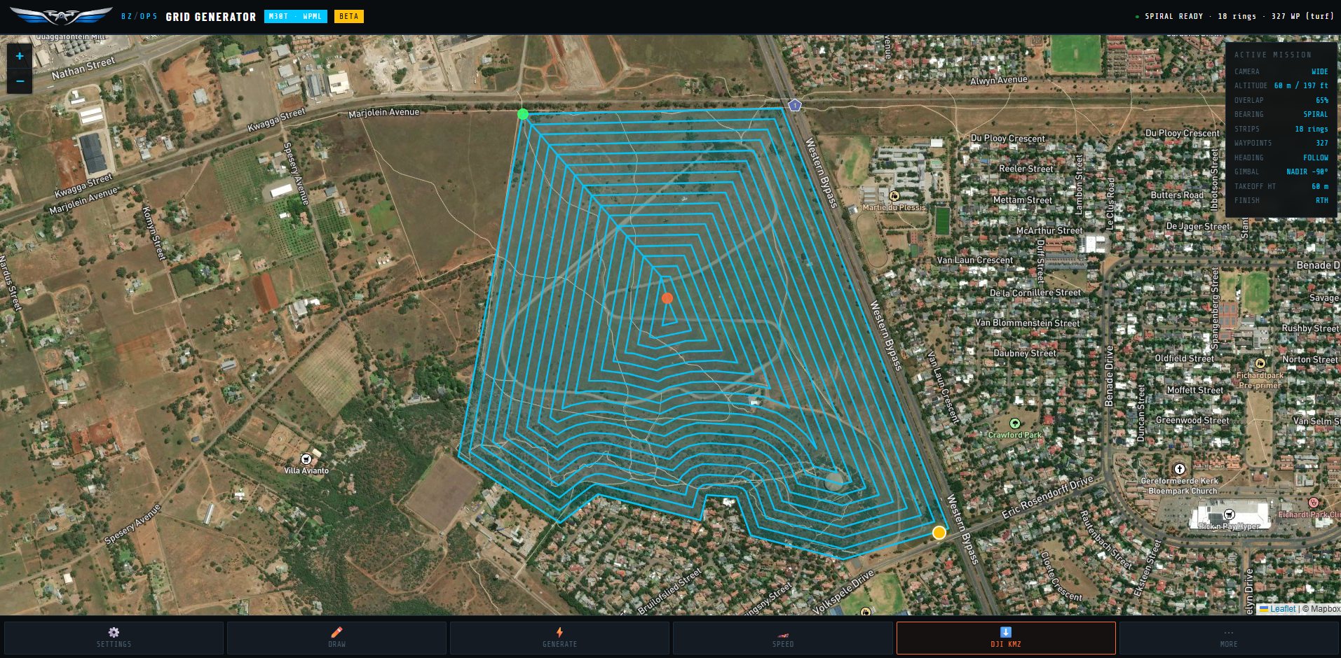
Lawnmower grid, spiral (containment or expanding), or hasty pin-drop for the quick first-pass over obvious places. Each pattern matches a phase of the SAR progression: hasty → POI → systematic.
Wide (daytime), Thermal (night / dense bush), or Split-screen (both feeds in one pass). The tool calculates strip spacing from the actual camera FOV.
Altitude, side overlap, speed, gimbal mode, RC-loss behaviour, RTH height. SAR-grade defaults (60% overlap, slow speed for thermal) — change anything you need.
Slow down over high-probability zones, fly fast over featureless terrain. Tap any strip on the map and set its individual speed.
Optional one-tap upload straight to your FH2 Route Library — skips the USB transfer entirely. Or download the .kmz the classic way.
Who it's for
If your mission ends with "… and I need to cover this area systematically", this tool is for you.
Supported drones
Fly a different DJI airframe? Hit Request another drone inside the tool — we'll email you when yours lands.
Free, anonymous, POPIA-compliant
- Free — no account, no card, no per-month fee. Just open the page and start drawing.
- Anonymous — no name, no email, no exact GPS, no full polygons. We track aggregate usage to know whether to keep building it; that's it.
- POPIA-aligned — Do-Not-Track honoured, ~1 km coarse centroid, salted-hashed IP for rate limiting only. Full detail in the privacy notice.
Built in South Africa
By BZ Tracking Solution (Pty) Ltd — the same team behind BizTrack and BizChat. We fly the M30T ourselves in our own field operations and use this tool every week. If something feels off, tell us — gustaff@biztrack.co.za.
Ready to plan a mission?
Draw your search area on the map. Generate the file. Import to Pilot 2. Fly.
Open the tool →Got an idea? Tell us.
This tool is shaped by feedback from people actually flying SAR missions. If something's missing, confusing, or wrong, tell us — email is optional, anonymous works too.